Solutions

Geospatial Mapping

Precision mapping, terrain intelligence, and spatial analytics that transform raw aerial data into actionable geospatial insights for critical infrastructure.

High-resolution orthomosaic mapping
Precision Mapping

High-Resolution Orthomosaic Mapping

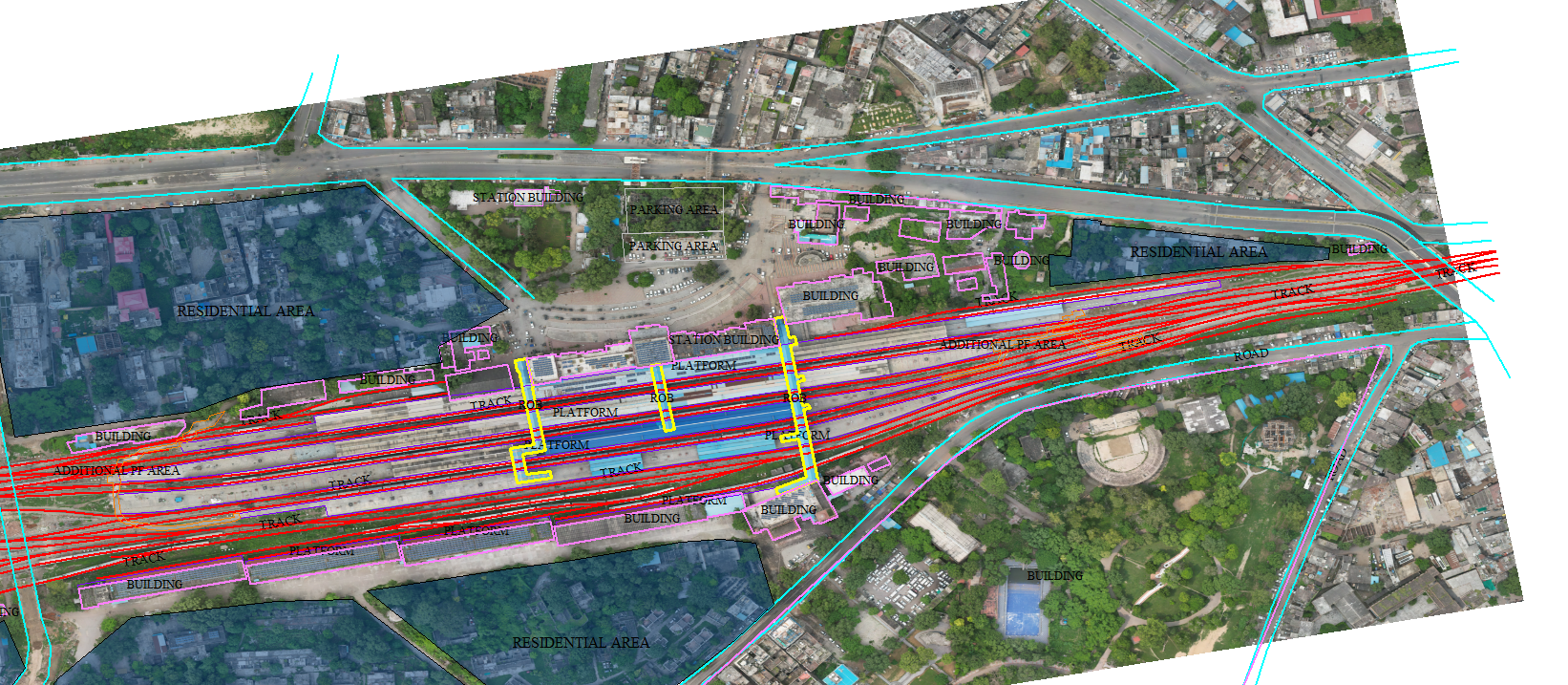
Sub-centimetre orthomosaic maps and 3D terrain models from drone imagery using photogrammetry and AI-assisted processing georeferenced and survey-accurate across any terrain type.

  • Sub-5cm ground sampling distance (GSD)
  • RTK GNSS georeferencing for survey-grade accuracy
  • GeoTIFF output compatible with all GIS platforms
  • Automated mosaicking and colour balancing
5cm
Ground Resolution
RTK
GNSS Accuracy
3D
Terrain Models
Auto
Mosaicking
LiDAR point cloud processing
LiDAR Scan Active
LiDAR Intelligence

LiDAR Point Cloud Processing

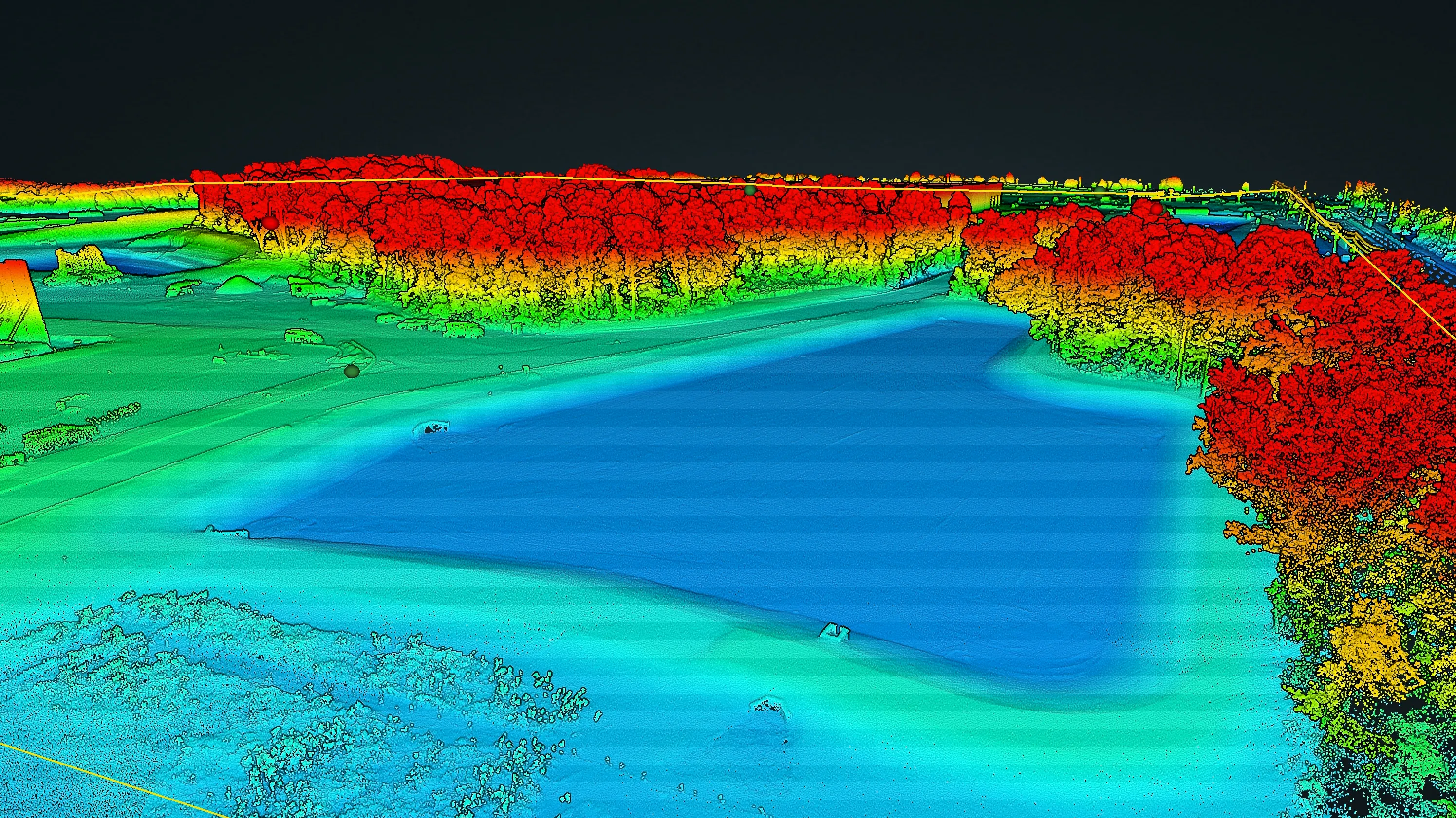
Classify, filter, and analyse dense LiDAR point clouds to extract ground models, vegetation layers, and structural features penetrating canopy to reveal bare-earth terrain at 2cm vertical accuracy.

  • Up to 1.2M points/second capture rate
  • Canopy penetration for bare-earth DTM generation
  • Volumetric calculations for stockpiles and excavations
  • LAS, LAZ, and DXF point cloud outputs
2cm
Vertical Accuracy
1.2M+
Points/Second
DTM
Bare-Earth Model
3
Output Formats
GIS integration and spatial analytics
GIS Integration

GIS Integration & Change Detection

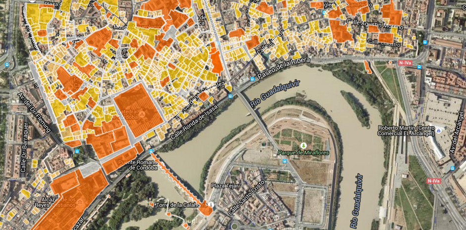
All outputs are delivered in standard GIS formats GeoTIFF, Shapefile, KML, GeoJSON, and DXF ready for ArcGIS, QGIS, and AutoCAD. Automated change detection flags terrain shifts, encroachments, and volumetric changes over time.

  • Compatible with ArcGIS, QGIS, AutoCAD, and more
  • Multi-temporal change detection and comparison
  • Attribute-rich vector layers for asset management
  • 10+ output formats including GeoTIFF, SHP, KML
10+
Output Formats
Auto
Change Detection
3
GIS Platforms
Vector
Asset Layers
Bathymetric survey and underwater mapping
Bathymetric Survey Active
Underwater Mapping

Bathymetry & Underwater Terrain Mapping

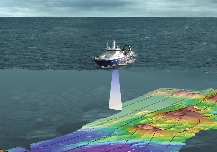
High-resolution underwater terrain mapping using autonomous drone and boat systems equipped with advanced sonar technology to capture riverbed, reservoir, and coastal floor topography with centimetre-level accuracy — without deploying divers or manual vessels.

  • Autonomous drone and boat systems for seamless surveys
  • Riverbed, reservoir & coastal floor profiling
  • Sediment accumulation & erosion change detection
  • Integrated above & below waterline 3D models
±3cm
Depth Accuracy
30m
Max Water Depth
Auto
Autonomous Survey
3D
Unified Models
Geospatial Mapping

Survey-Grade Intelligence at Scale

2000+ Sq Ft Area Mapped
<5 cm Ground Resolution
2 cm Vertical Accuracy
10+ Formats GIS Output Types
±3 cm Bathymetric Depth

Ready to Map Your World?

Talk to our geospatial experts and discover how Aerovania can transform your survey operations.

Get in Touch
Aerovania
Contact Us