Topographic aerial surveys, construction progress monitoring, and highway corridor mapping for NHAI and state highway authorities 10x faster than ground surveys.
Aerovania delivers drone-based topographic surveys, corridor mapping, and construction progress monitoring for national and state highways replacing slow ground surveys with fast, accurate aerial intelligence.
High-resolution drone surveys capture sub-5cm topographic data across highway corridors replacing weeks of ground survey with hours of aerial data collection for DPR and alignment studies.
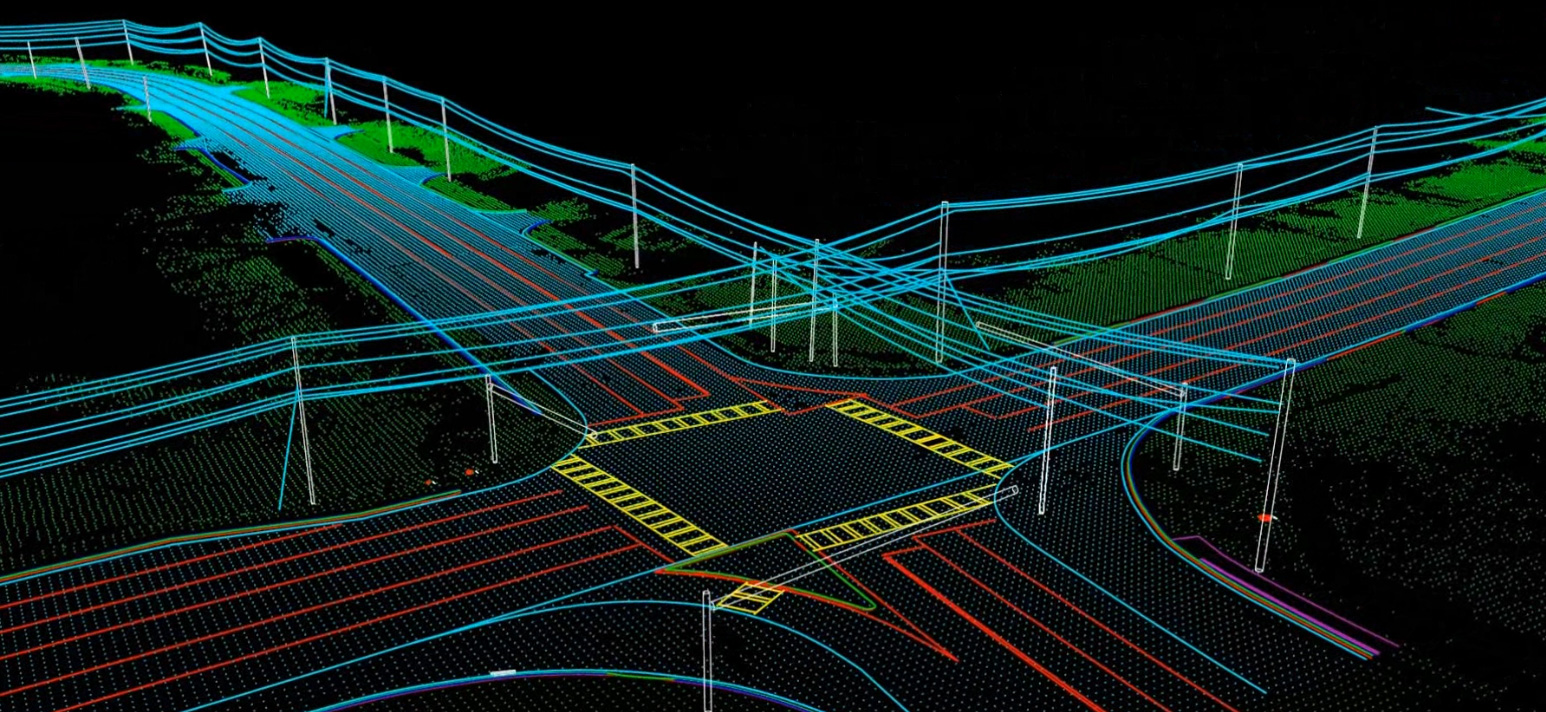
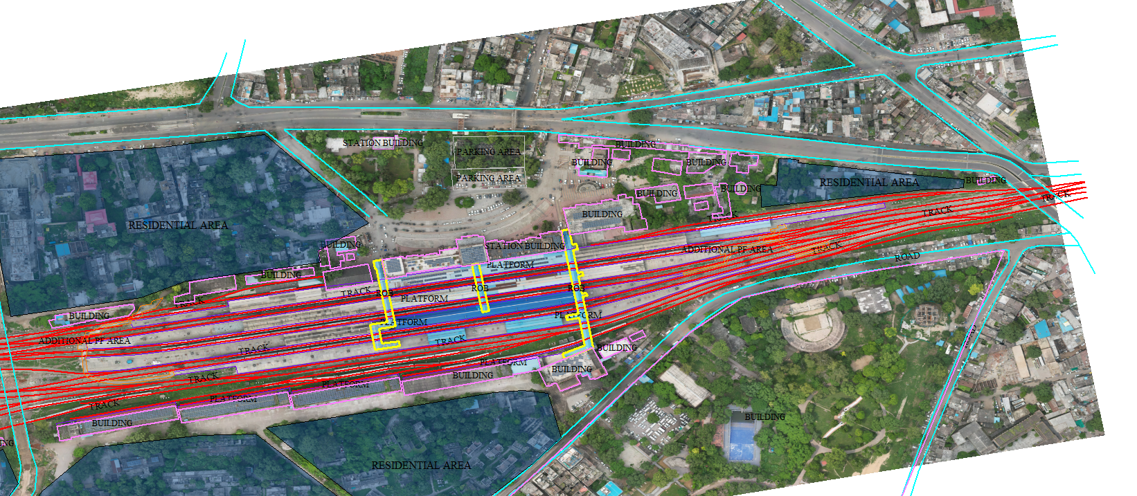
LiDAR-based corridor surveys map the full highway right-of-way capturing road geometry, drainage, utilities, and encroachments along the alignment for design and asset management.
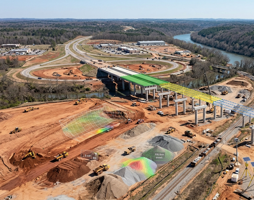
Regular drone surveys track construction progress against project plans providing contractors and project managers with accurate, up-to-date earthwork volumes and schedule adherence data.
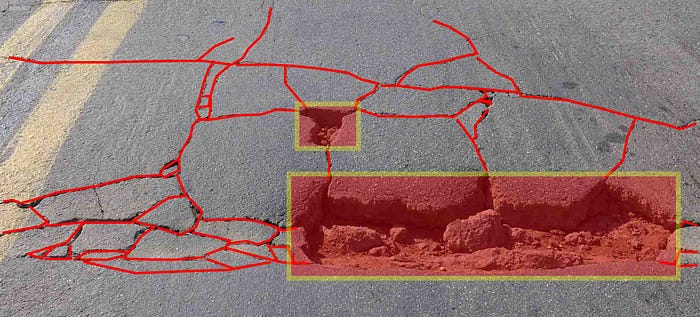
AI-powered analysis of drone imagery detects pavement defects, surface irregularities, and construction quality issues enabling early intervention before defects become costly repairs.
Purpose-built for NHAI and state highway authorities.
Sub-5cm ground resolution across topographic surveys meeting NHAI DPR and alignment study requirements.
Replace multi-week ground surveys with drone-based data collection completed in hours across large highway corridors.
Automated detection of encroachments, utilities, and boundary violations along the full right-of-way.
Regular drone surveys track construction progress against approved plans for accurate schedule management.
Aerovania is empanelled with NHAI and NHIDCL for drone-based survey and monitoring services.
Survey outputs integrate directly with GIS platforms, highway design software, and project management systems.
Drones fly the full ROW capturing sub-5cm topographic data in hours.
LiDAR maps road geometry, drainage, utilities and encroachments.
Regular surveys compare earthwork volumes against project plans.
GIS-ready outputs delivered in DXF, GeoTIFF, and Shapefile formats.
Talk to our highway mapping team about drone-based surveys and progress monitoring solutions.